
Route alignment and the design of earthworks should respond to the broad scale of the topography as well as to smaller-scale landforms. The guiding principle is to work with the topography using engineering elements to minimise habitat fragmentation by maximising the opportunities for connectivity below and above the infrastructure (Figure 4.3.1). A good alignment is expected to integrate well with its surroundings from both how the landscape is perceived and how ecological connectivity is preserved by allowing the free movement of fauna. Solutions ensuring these aspects must be implemented as often as possible, finding compromises to achieve the best balance between the two.
Hills and mountains
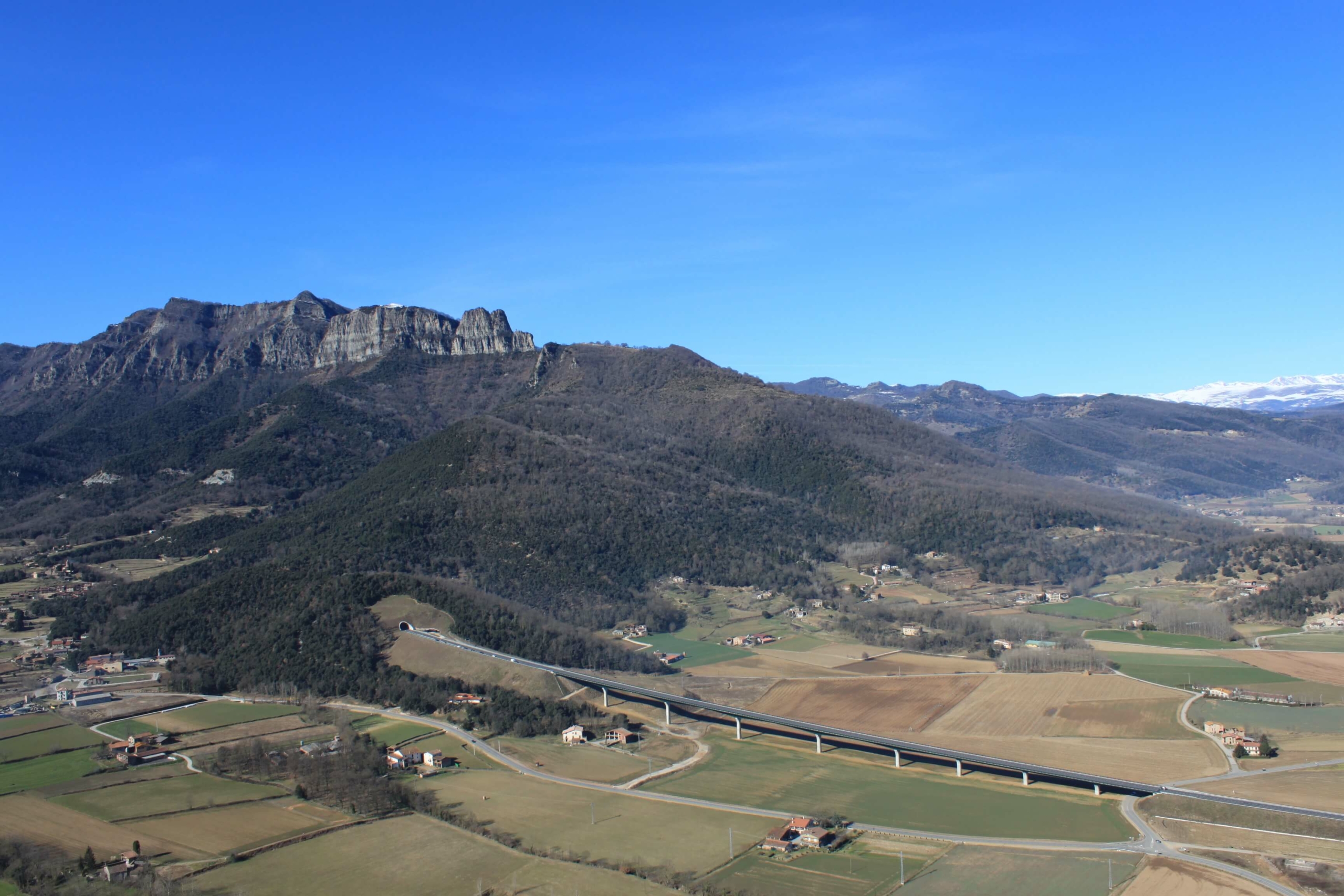
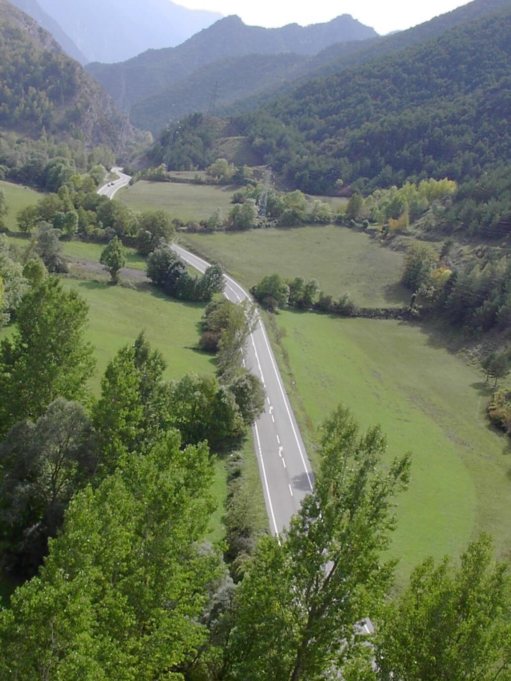
In hilly or mountainous landscapes, the most common alignment is placing linear transport infrastructure at the bottom of valleys (Figure 4.3.2). While such alignments are generally acceptable from a perceptual point of view, they often present problems in designing efficient measures to permit species cross the infrastructure. In addition, the difficulty usually increases with steeper surrounding hills or mountains and when natural barriers such as rivers and anthropogenic barriers already exist in the area, including other linear infrastructure and built areas in valleys. Such accumulation of old and new, natural and human-made barriers often leads to a complete block on wildlife movement perpendicular to the axis of the valley (Figure 4.3.3).
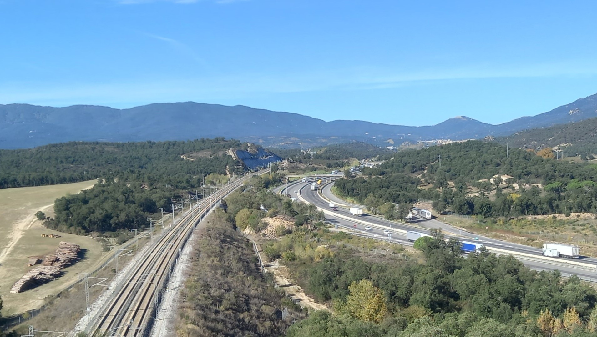
Aligning transport infrastructure away from the valley bottom and integrating it into the slopes of the adjacent hills or mountains is a solution that limits the cumulative barrier effect. However such solutions are often more technically demanding and costly, requiring more extensive interventions in natural habitats, but do present benefits for people and wildlife (see Chapter 2 – Policy, strategy and planning).
The permeability to wildlife of hilly and mountainous landscapes is particularly impacted by concentrations of housing and associated infrastructure at the valley bottom. Spatial planning is the best tool to appropriately manage urban development with the conservation of connectivity and biodiversity. Spatial planning and transport infrastructure planning/design in these areas must pay particular attention to:
- Identifying critical crossing points for fauna and flora in the valley which should be protected from urbanisation.
- Linking ecological corridors preserved in areas of housing development with wildlife passages constructed in the transport linear infrastructure.
- Designing, as much as possible, functional wildlife underpasses (particularly adapted viaducts) when the transport infrastructure crosses watercourses or small valleys instead of small culverts only designed for hydrological purposes (see Chapter 5 – Solutions to mitigate impacts and benefit nature).
In general, aligning transport infrastructure at the valley bottom may only be satisfactory when impacts on watercourses and other natural linear features is mitigated and connectivity between both sides of the valley is maintained.
Alignments following the top of a major ridge provide acceptable visual perception, as the infrastructure remains hidden from the human eye. Even minor ridges offer opportunities for such sensitive alignment. This alignment may also bring some benefits for wildlife, for example a reduction in traffic noise and illumination disturbance impacts. However, without sufficient and safe wildlife passages, it too can have a strong barrier effect, similar to that at valley bottom. Measures to reduce the risk of bird collision are also a concern in this situation (see Chapter 5 – Solutions to mitigate impacts and benefit nature).
Where the alignment of infrastructure involves the sloping sides of a valley, the intrusion into natural habitats can be significant. In such situations, earthworks need to be properly located and designed. Major earthworks can be avoided by following contours high up the valley side. Split carriageways and restored graded-out slopes can be effective design solutions. Care must be taken not to grade out slopes where valuable habitats or species may be present.
Flat landscapes
Many different habitats can be present in flat landscapes. Alignment in this type of environment should be sensitive to the landscape scale and context and use spatial planning to consider habitats of species present. Some key principles to be followed are:
- Aligning infrastructure level with local terrain for good incorporation into the surrounding landscape. Existing topographical features should be used as alignments which respect local drainage and sensitive habitats are often the best.
- Avoid steep, intrusive embankments.
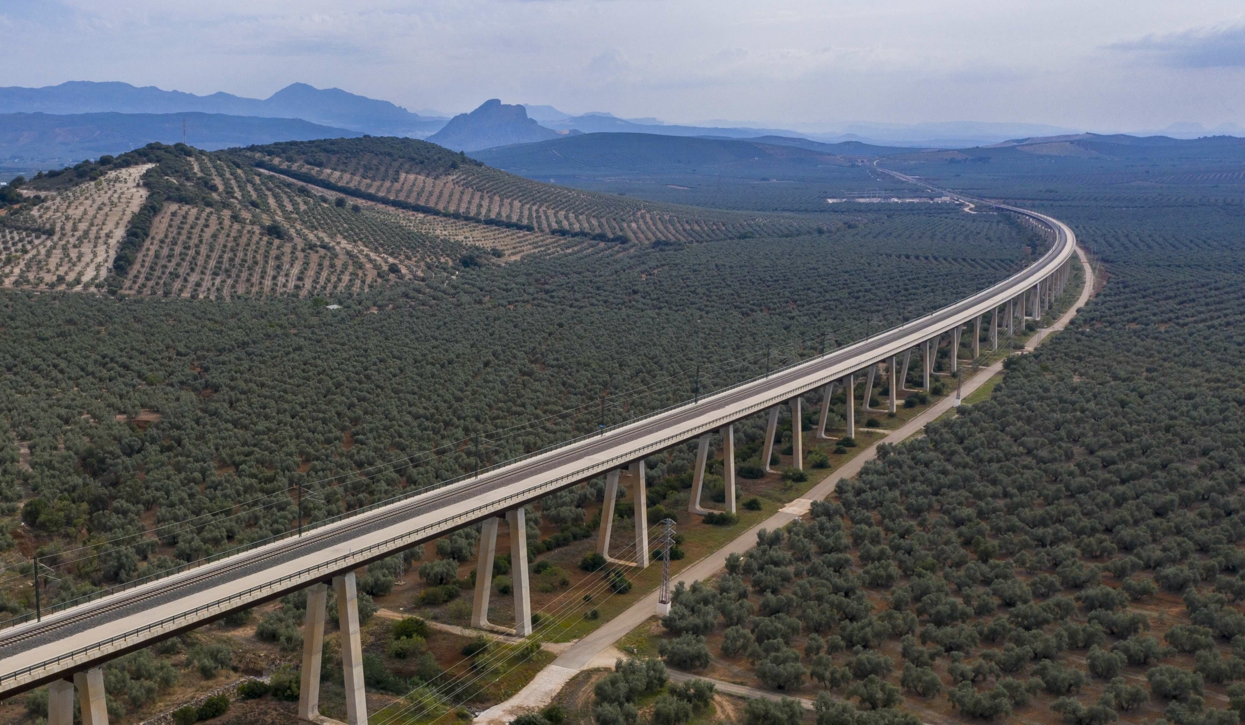
- Prioritise viaducts over other solutions as they maintain species connectivity (Figure 4.3.5; see Chapter 5 – Solutions to mitigate impacts and benefit nature. Adapted viaducts (Landscape underpasses)).
- Minimise habitat fragmentation by integrating wildlife passages for target species. Good solutions in flat landscapes may be smaller, well-designed passages. For example, culverts with dry ledges (see Chapter 5 – Solutions to mitigate impacts and benefit nature. Adapted culverts) or amphibian passages in low-level embankments (see Chapter 5 – Solutions to mitigate impacts and benefit nature. Amphibian passages). Flat landscapes, particularly wetlands, are often of high nature conservation value and in the event that aligning infrastructure through such an area is unavoidable, a viaduct is the best solution, minimising land use, soil disturbance and the barrier effect.
- In cases of alignments crossing ecological corridors, connectivity can generally be preserved by appropriate design of an ecoduct (see Chapter 5 – Solutions to mitigate impacts and benefit nature. Landscape overpasses).
Crossing valleys and rivers
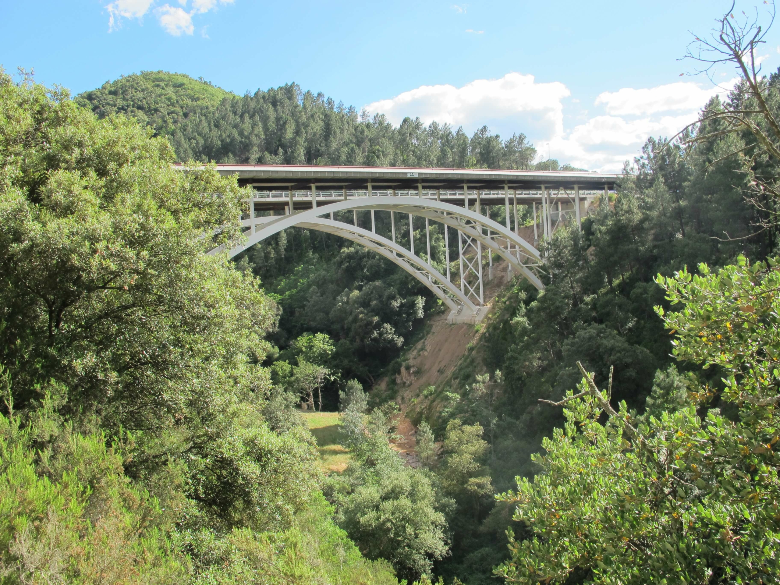
Infrastructure can be carried across valleys on embankments or viaducts.Viaducts have environmental advantages subject to the choice of an appropriate crossing location. Viaducts are suited to narrow, steep-sided valleys as they minimise land use, fragmentation and enable species movement. Embankments are more suited to wide, shallow valleys as they can maintain some degree of connectivity through the use of appropriately designed culverts and underpasses as well as offering more scope to restore vegetation.
When linear infrastructure crosses over a watercourse the basic principle is to maintain as far as possible the natural state of the stream bed, stream flow and riparian vegetation (Figure 4.3.6). The landscape restoration design where infrastructure cross watercourses radically influences the possibility to preserve fauna movement as well. In general, following this basic principle together with a sound design that is appropriate for the type of infrastructure, size of the watercourse and needs of the animal species present, usually provides a good solution. This approach should be followed at the same time as a requirement to safely manage extreme flood waters, which are expected to occur more frequently due to climate change (see Chapter 5 – Solutions to mitigate impacts and benefit nature. Adaptation of infrastructure to climate change: risk and opportunities for biodiversity).
Local materials should be employed within a site-specific design. It is important to ensure that animals are able to climb out of rivers, streams, and ditches and therefore Nature-based Solutions should be applied (see Chapter 5 – Solutions to mitigate impacts and benefit nature). Steep banks and concrete elements should be avoided, but where these are absolutely necessary, exit steps or inset shallow slopes should be provided. Nature conservation opportunities include the associated planting of particular native species adapted to wetland and river habitats (e.g., willow species) or creation of special features such as nesting opportunities for birds, breeding opportunities for amphibians and other elements on banks which benefit small mammals.
Crossing Sensitive Natural Areas
When infrastructure is planned near sensitive, high value areas to nature, the first principle is always to avoid the construction of infrastructure which could cause negative impacts in such areas (see Chapter 3 – The mitigation hierarchy). If complete avoidance is not possible, then a comprehensive evaluation of the wider area of interest should be performed to set priorities, devise and compare various solutions and select that with minimal negative impacts. Such an assessment requires a great deal of information and assessing the quality of habitats from many different viewpoints, including amongst others classification according to the Natura 2000 network, national legislation, the function and category of potential wildlife corridors, occurrence of protected species, representation of the given habitat within the area of interest and within a broader region, and the state of the given habitat as far as long-term population viability. The resulting assessment should provide a map of habitats in the area, including their categorisation based on quality and conservation interest. This map then forms the basis for a decision on the final alignment. In this decision, several criteria besides the habitat quality also need to be considered, including:
- Avoiding impact on core areas (in situations where the area is not homogeneous in its quality).
- Reducing the land occupied by infrastructure avoiding impacts on the area of interest.
- Mitigating the potential habitat fragmentation caused by the infrastructure and its effects.
Protection of sensitive areas is critical in the selection of possible variants. However it is necessary to search for the optimal solution in relation to all environmental elements.
Crossing urban and suburban landscapes
Urban and suburban landscapes have a strongly anthropogenic character with elements of industrial, transport and housing infrastructure dominating the natural elements present. However, Green Infrastructure may also be integrated in such areas and must be preserved from transport infrastructure impacts. Application of Nature-based Solutions and ecological restoration of natural areas even in highly artificialized landscapes, is expanding all around Europe and offers opportunities to enhance biodiversity.
Spatial planning must be central to ensure the coherence of ecological connectivity across housing and transport infrastructure. The basic principles for aligning routes in such areas are:
- Reduce the impacts on human inhabitants (e.g., the reduction of noise and air pollution) while not ignoring the impacts on nature.
- Minimise interventions to small and less preserved natural elements which have relevance in this context and which in other landscape types, would remain unnoticed (e.g., forest patches, minor streams, trees and shrubs and all other natural elements that contribute to biodiversity conservation).
- Support ecological connectivity to surrounding natural habitats from inside the urban landscape for relevant species, avoiding the creation of ‘ecological traps’ (see Chapter 1 – Ecological effects of infrastructure) or attraction of species which may cause damage.
- Aim to reduce the probability of large and medium-size mammals, as well as invasive species, entering urban areas.